Garfield County Sheriff’s Office
Garfield County, the Garfield County Sheriff’s Office, Bureau of Land Management (BLM), the U.S. Forest Service, and the seven fire districts in Garfield County are implementing Stage 1 fire restrictions effective at midnight on Thursday, June 26, 2025. This applies to all of Garfield County.
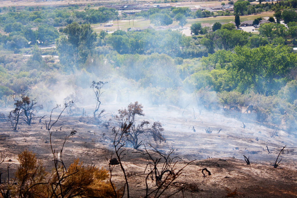
This decision was made with thoughtful consideration. We look at the data, the potential for significant wildfires, and balance it with the impacts to our community. Our concern, with the level of fire danger we are seeing; one spark could quickly spread into a dangerous wildfire threatening lives, property, and natural resources.
Fire restrictions are implemented based on specific criteria, including moisture content of vegetation, weather outlooks, human risk factors, and firefighting resource availability. It has been hot, dry, and unseasonably windy. So far this year, we have had several Red Flag warnings. The National Weather Service is forecasting above average temperatures and dry conditions with no relief from rain anytime soon.
With increasingly dry vegetation, severe drought conditions, and more hot and dry conditions approaching, the danger for human-caused wildfires increases even more.
What Stage I fire restrictions mean in Garfield CountyFireworks are not allowed under Stage I Fire Restrictions. Professional fireworks shows may be allowed through the permitting process.All burn permits are postponed/Canceled until further notice.Campfires are only allowed within designated fire grates in developed areas (i.e. a permanent in-ground containment structure or store bought fire pit) A temporary fire pan and rock campfire rings will not be acceptable.No fires of any type including charcoal in undeveloped areas.No smoking except within a designated area, enclosed vehicle or building, a developed area or in an area free of combustibles.No use of fireworks or explosive materials, including “exploding” targets or bullets and tracer rounds.Exercise common sense and industry safety practice when welding or operation of an acetylene or other similar torch with open flame always cleared safe area of vegetation and combustibles.
Penalties
Causing a fire during fire restrictions can be a class 6 felony and can be punishable by fines. Other possible charges range from a Class 2 felony to a petty offense depending on the value of the damage caused. You may be held financially responsible for damage caused.
Federal lands
The use of fireworks, flares, or other incendiary devices, including exploding targets, are always prohibited on Federal lands.
By definition:
A “developed area” is an area, whether within city limits or rural, that is groomed, manicured and or watered, where grasses, brush and trees are regularly attended to by landowner. This includes residential and business areas, improved recreational areas, parks and other common areas.
An “undeveloped area” are lands that are not groomed, manicured, or watered, where grasses, brush and trees have been allowed to grow in a natural environment. This includes green belts that are not landscaped or manicured, open space lands, non-manicured park lands, and other areas where the fire hazard presented by the vegetation is determined by the authority having jurisdiction or designee to be an undue wildland fire hazard.
U.S. Forest Service and the Bureau of Land Management
White River National Forest and BLM Upper Colorado River District to enact stage 1 fire restrictions
June 25, 2025, 1:04 p.m. – GRAND JUNCTION, Colo. – All lands managed by the White River National Forest and the Bureau of Land Management Upper Colorado River District will be under stage 1 fire restrictions beginning Friday, June 27.
Under stage 1 restrictions for the Bureau of Land Management and White River National Forest:
- campfires are only allowed within designated fire grates in developed campgrounds (including the Forest Service Homestake Valley designated dispersed camping sites in Eagle County); this means a metal, in-ground containment structure — fire pans and rock campfire rings are not acceptable.
- no fires of any type including charcoal outside of developed areas
- no smoking except within an enclosed vehicle or building, a developed recreation site or in a barren area free of vegetation
- no use of explosive materials, including explosive targets
- no welding or operation of an acetylene or other similar torch with open flame except from an area that has been cleared of vegetation
- no operation of any internal combustion engine without a spark arresting device properly installed and in working order
Although conditions vary across the area, a longer-term drying trend is expected to continue.
“Fire restrictions are prudent at this time considering the long-range forecast, fuel moisture conditions on the ground, and the continued high public visitation,” said White River National Forest Supervisor Brian Glaspell. “In developed campgrounds where campfires are permitted, please ensure your fire is completely out and cold before leaving.”
“As we enter stage 1 fire restrictions, it’s crucial for everyone to understand the importance of fire safety during this dry season,” said BLM Upper Colorado River District Manager Greg Larson. “We urge all residents and visitors to be vigilant and responsible with any outdoor activities that could spark a fire. Remember, fireworks are not allowed on federal land.”
Officials consider several criteria when determining the need for fire restrictions, including current and anticipated fire danger, resource availability, and consistency with neighboring jurisdictions. Local, county, state and federal officials within this area evaluate and coordinate fire restrictions weekly during fire season.
BLM Grand Junction and Colorado River Valley Field Offices, part of the BLM Upper Colorado River District, and unincorporated private lands in Eagle, Garfield, Mesa, Pitkin and Summit counties will also enter fire restrictions this week.