GarCo911: Hilltop Fire on County Road 320/CR 309 – EVACUATE the area immediately

A brush fire near County Roads 320 and 309, near Rifle, CO.

Garfield County Emergency Communications Authority

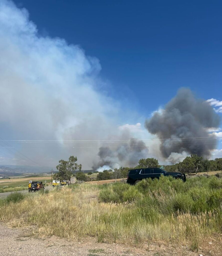
This incident has been named the Hilltop Fire.

June 26, 2025, 3:35 p.m. PRE-EVACUATION: Residents over one mile, but within two miles of county road 320/county road 309: Due to a Fire, please prepare for possible evacuation orders issued by Garfield County Sheriff’s Office. You will receive another message if evacuations are ordered.

June 26, 2025, 3:26 p.m. EVACUATION: If you are EAST of the fire, EVACUATE to the FAIRGROUNDS in Rifle, if you are WEST of the fire EVACUATE to COTTONWOOD PARK/PARACHUTE FAIRGROUNDS. 
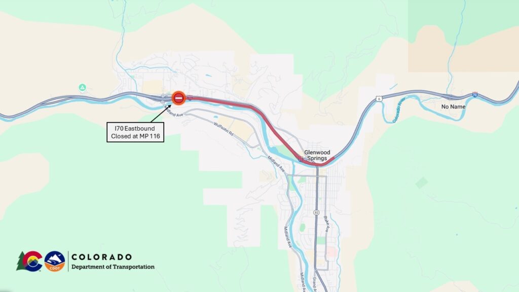
June 26, 2025, 3:06 p.m.EVACUATION: County Road 320 (Rifle-Rulison Road) and County Road 309 (Rulison-Parachute Road: Due to fire, EVACUATE the area immediately.

GarCo911: Incendio en County Road 320/CR 309: EVACUAR el área inmediatamente

26 de junio de 2025, 15:35AVISO DE PREEVACUACION: a más de una milla, pero a menos de dos millas de la carretera del condado 320/carretera del condado 309: Debido a un incendio, por favor, prepárense para posibles órdenes de evacuación emitidas por la Oficina del Sheriff del Condado de Garfield. Recibirán otro mensaje si se ordena la evacuación.

26 de junio de 2025, 15:26EVACUACION: Carretera del Condado 320/Carretera del Condado 309: Debido al incendio, evacue la zona inmediatamente. Si se encuentra al ESTE del incendio, evacue al RECINTO FERIAL de Rifle; si se encuentra al OESTE del incendio, evacue al PARQUE COTTONWOOD/RECINTO FERIAL DE PARACAIDISTAS.

26 de junio de 2025, 15:06EVACUACION: County Road 320 (Rifle-Rulison Road) y County Road 309 (Rulison-Parachute Road): debido al incendio, evacue el área inmediatamente.

Garfield County Sheriff’s Office

June 26, 2025, 3:38 p.m. – Brush Fire at County Road 309 (Rulison area), moving East and South. Pre-evacuation starting at County Road 329. Evacuations in place 1 mile West and East from Intersection of County Road 309 & 320. If you are on the West side you may evacuate to Parachute Fairgrounds on the East side to Garfield County Fairgrounds.

26 de junio de 2025, 15:38 – Incendio forestal en la carretera del condado 309 (zona de Rulison), avanzando al este y al sur. Se inicia la preevacuación en la carretera del condado 329. Se han establecido evacuaciones a 1.6 km al oeste y al este de la intersección de las carreteras del condado 309 y 320. Si se encuentra en el lado oeste, puede evacuar al recinto ferial Parachute, ubicado en el lado oeste, al recinto ferial del condado de Garfield.

Holy Cross Energy

June 26, 2025, 3:28 p.m. – Power is out in the Rulison to Parachute area due to fast-moving wildfire activity. Please avoid the area and take all necessary safety precautions.

26 de junio de 2025, 15:28 – Se ha producido un corte de electricidad en la zona de Rulison a Parachute debido a la rápida actividad de los incendios forestales. Evite la zona y tome todas las precauciones de seguridad necesarias.

GarCo911: Hilltop Fire on County Road 320/CR 309 – EVACUATE the area immediately

GarCo 911: Pre-evacuation lifted for fire in West Glenwood

Glenwood Springs Fire Department

June 23, 2025, 3:53 p.m. – Fire is contained.

Glenwood Springs Police Department

June 23, 2025, 3:34 p.m. – We are responding to a brush fire in the West Glenwood Area. Donegan Road has been closed in both directions between Vista Drive and Sunny Acres Road. Please avoid this area for emergency responders.

Garfield County Emergency Communications Authority

June 23, 2025, 3:58 p.m. – Sunny Acres residents: Pre-evacuation has been lifted by the Glenwood Springs Police Department. The fire is contained.

June 23, 2025, 3:34 p.m. – Sunny Acres residents: Due to a fire, please prepare for possible evacuation orders issued by the Glenwood Springs Police Department. You will receive another message if evacuations are ordered.

Se ha levantado la evacuación previa

23 de junio de 2025, 15:58 – Residentes de Sunny Acres: El Departamento de Policía de Glenwood Springs ha levantado la orden de evacuación. El incendio está contenido.

23 de junio de 2025, 15:34 – Residentes de Sunny Acres: Debido a un incendio, les pedimos que se preparen para posibles órdenes de evacuación emitidas por el Departamento de Policía de Glenwood Springs. Recibirán otro mensaje si se ordena la evacuación.

GarCo 911: Pre-evacuation lifted for fire in West Glenwood

Garfield County Sheriff’s Office: Evacuation lifted and I-70 open in Rulison area between Parachute and Rifle

Garfield County Emergency Communications Authority

6.20.25, 10:20 p.m. – Road open – I-70 is open between mile markers 75 to 87 both directions, between Parachute and west Rifle.

6.20.25, 8:08 p.m. – Evacuation lifted – Rulison area evacuation has been lifted.

6.20.25, 8:03 p.m. – Road open – Highway 6 is open between mile markers 75-87 both directions, from Parachute to west Rifle. I-70 remains closed at this time.

Autoridad de Comunicaciones de Emergencia del Condado de Garfield

6.20.25, 10:20 pm – Camino abierto – La I-70 está abierta entre los marcadores de millas 75 a 87 en ambas direcciones, entre Parachute y el oeste de Rifle.

6.20.25, 8:08 pm – Se levanta la evacuación – Se ha levantado la evacuación del área de Rulison.

6.20.25, 8:03 p. m. â€“ Carretera abierta. La autopista 6 está abierta entre los marcadores de millas 75 y 87 en ambas direcciones, desde Parachute hasta el oeste de Rifle. La I-70 permanece cerrada en este momento.

Garfield County Sheriff’s Office

Evacuation has been ordered for Rulison area

6.20.25, 6:23 p.m. – Evacuations ordered for Rulison area: one mile east of the 81 and one mile west of the 81 evacuate to the Garfield County Fairgrounds.

Garfield County Emergency Communications Authority

6.20.25, 6:05 p.m. – EVACUATE IMMEDIATELY IN AREA OF FIRE: Rulison Area: Due to the fire, evacuate the area immediately. All people and small animals (as well as large animals) should go to the Garfield County Fairgrounds.

I-70 is closed between mile markers 75 and 87 westbound, from Parachute to West Rifle, due to a fire.

Oficina del Sheriff del Condado de Garfield

Se ha ordenado la evacuación del área de Rulison.

6.20.25, 6:23 pm – Se ordenaron evacuaciones para el área de Rulison: una milla al este de la 81 y una milla al oeste de la 81, evacuen al recinto ferial del condado de Garfield.

Garco911/CDOT: I-70 en dirección oeste cerrada entre Parachute y el oeste de Rifle

EVACUAR INMEDIATAMENTE – Ãrea de Rulison: Debido al incendio, evacue el área inmediatamente. Todas las personas y animales pequeños (así como los animales grandes) deben dirigirse al recinto ferial de Rifle.

La I-70 está cerrada entre los marcadores de millas 75 y 87 en dirección oeste, desde Parachute hasta West Rifle, debido a un incendio.

Garfield County Sheriff’s Office: Evacuation lifted and I-70 open in Rulison area between Parachute and Rifle

Garco911/CDOT: I-70 westbound closed between Parachute and west Rifle

Colorado Department of Transportation

6.20.25, 5:47 p.m. – Between Exit 90: CO 13; Rifle (Rifle) and Exit 75: Parachute (Parachute) from mile point 87 to mile point 75. Road closed, expect delays due to safety concerns.

Comment: Large brush fire near interstate, both lanes closed for safety. US-6 is also closed.

Please plan for delays and use EXTREME CAUTION as conditions change rapidly.

Garfield County Emergency Communications Authority

6.20.25, 5:34 p.m. – I-70 is closed between mile markers 75 and 87 westbound, from Parachute to West Rifle, due to a fire.

Garco911/CDOT: I-70 westbound closed between Parachute and west Rifle

GarCo911: Eastbound I-70 is open at Glenwood Springs

Colorado Department of Transportation

Map showing the location of eastbound Interstate 70 closure near Glenwood Springs.

April 24, 2025, 10:10 a.m. – Interstate 70 eastbound lanes are closed near Glenwood Springs with detours in place for commuters. It is not known when the interstate will open for eastbound travelers. At approximately 8 a.m. a commercial vehicle hauling cattle crashed onto its side and blocked both eastbound lanes of traffic near Mile Point 116, just west of the Grand Avenue exit. For local traffic, I-70 eastbound remains open up to Exit 114, West Glenwood. Colorado Department of Transportation, Glenwood Springs Police, and other first responder agencies are on the scene.

Commuters are urged to proceed with caution along the detour routes listed below.

Northern alternate route

To use the northern alternate route, eastbound commuters will take Colorado Highway 13 in Rifle north to Craig. In Craig, turn east on US highway 40 to Steamboat Springs. Just outside of Steamboat Springs, take either CO 131 south and back on to I70 or US 40 and continue east. 

Southern alternate route

To use the southern alternate route, eastbound motorists from the Grand Junction area can travel on US 50 US 285 through Gunnison, and continue to Denver and areas nearby. Note: Cottonwood Pass on CO 306 is still closed for the season and not a viable alternative route.

Glenwood Springs Police Department

April 24, 2025, 9:31 a.m. – Glenwood Springs Police Department: Exit 114 is open.
Exit 116, all lanes remain closed due to an accident involving a semi carrying cattle. No estimated time of reopening. Detour in place north via Rifle CO-13 to Craig US-40 & South Clifton/Montrose US-50 to Leadville US-24.

Garfield County Emergency Communications Authority

April 24, 2025, 2:13 p.m. – Eastbound I-70 is open at Glenwood Springs.

April 24, 2025, 9:40 a.m. – Eastbound Interstate 70 remains closed at mile marker 114, West Glenwood exit, and has moved back to eastbound mile marker 116, the main Glenwood Springs exit.

April 24, 2025, 8:08 a.m. – Eastbound Interstate 70 is closed at mile marker 114, West Glenwood exit, due to an accident.

GarCo911: Eastbound I-70 is open at Glenwood Springs

Garco911: I-70 open in Glenwood Canyon

Garfield County Emergency Communications Authority

4.22.25, 2:12 p.m. – I-70 is open at Glenwood Springs. Both eastbound lanes are open and one westbound lane.

4.22.25, 1:41 p.m. – Eastbound I-70 is open at Glenwood Springs. Only eastbound lanes are open at this time.

4.22.25, 12:06 p.m. – Road closed: I-70 is closed between mile markers 116-133, both directions, Glenwood Springs to Dotsero, due to an accident.

Garco911: I-70 open in Glenwood Canyon