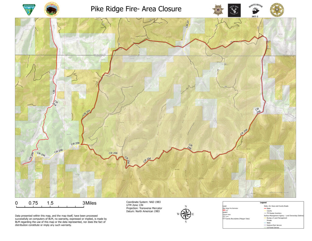
Garfield County Sheriff’s Office
Morissania Mesa Fire Management returned to the Grand Valley Fire Protection District
10.3.23, 7:40 p.m. – GARFIELD COUNTY, CO. – Containment of the Morrisania Mesa Fire stands at 85% as of this evening. During the fire, which started Saturday evening September 30, one house was lost at 2879 County Road 301 and one large shop, both owned by the same family.
Incident Commander Chris Bornholdt with Garfield County Emergency Services will be turning control and management of the fire back over to the Grand Valley Fire Protection District as of midnight tonight. The County assumed control and management of the fire Saturday night through Emergency Services Commander Bornholdt. It was determined that the rapid growth of the fire would require additional resources and people power on the ground and in the air. The county stepped up in this instance because the resources that would be needed are not readily available to local districts or are cost prohibitive. The final goal was to minimize the spread of the fire and protect property and residents in the area.
In the final analysis, the fire turned out to be 61 acres, not the originally estimated 100 acres. Grand River Fire District will monitor the fire until it can be categorized as 100% contained.
This will be the final press release from Garfield County concerning the Morissania Mesa Fire. Thanks to all who assisted and to the residents of Garfield County for their cooperation and assistance in this matter.
Morrisania Mesa (Rulison) Fire update
10.3.23, 10:01 a.m. – As of Monday evening October 2, 2023, the Morrisania Fire is 75% contained. All evacuation orders have been lifted, but residents in the area still need to be on high alert.
The road closures have been lifted as of this Tuesday Morning October 3, but please stay out of the area, as fire equipment is still moving around working the fire. Residents are free to move their livestock back into the area today.
There has been no fire growth over the past couple days. The fire is estimated at 100 acres, we will have numbers that are more accurate this afternoon.
There are 15 firefighters working the fire today and checking for hot spots. Today’s teams include the Rocky Mountain National Park MOD 32, Grand Valley Fire Protection District and the Garfield County Sheriff’s Office.
The Garfield County Sheriff’s Office wants to thank the residents of Garfield County for their continued cooperation in this matter and their support of all our first responders.
Residence Lost in Rulison Fire at 2879 County Road 301
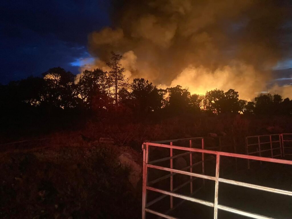
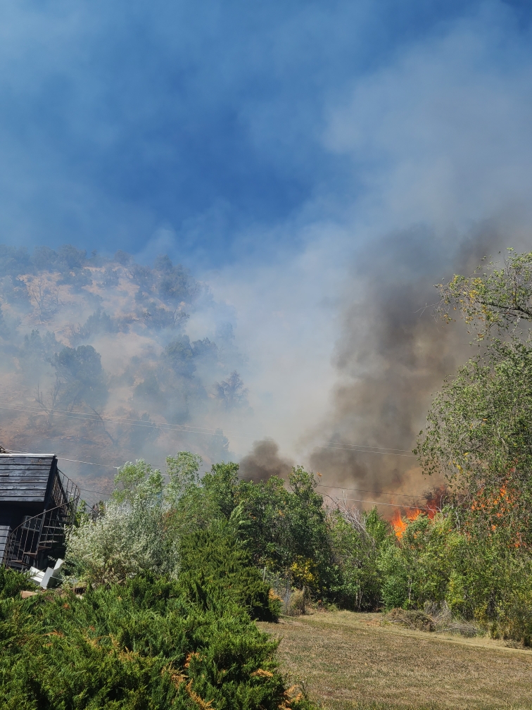
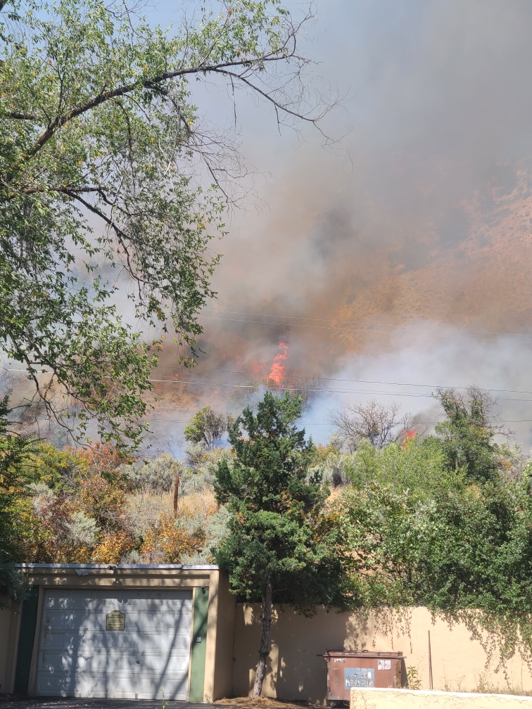
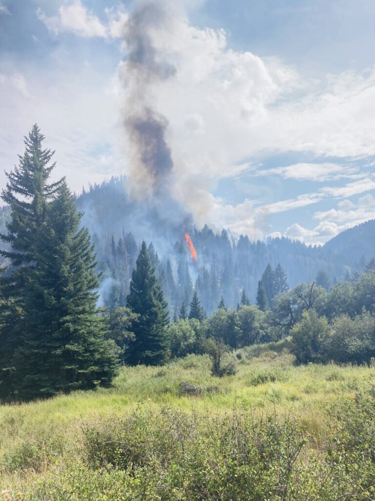
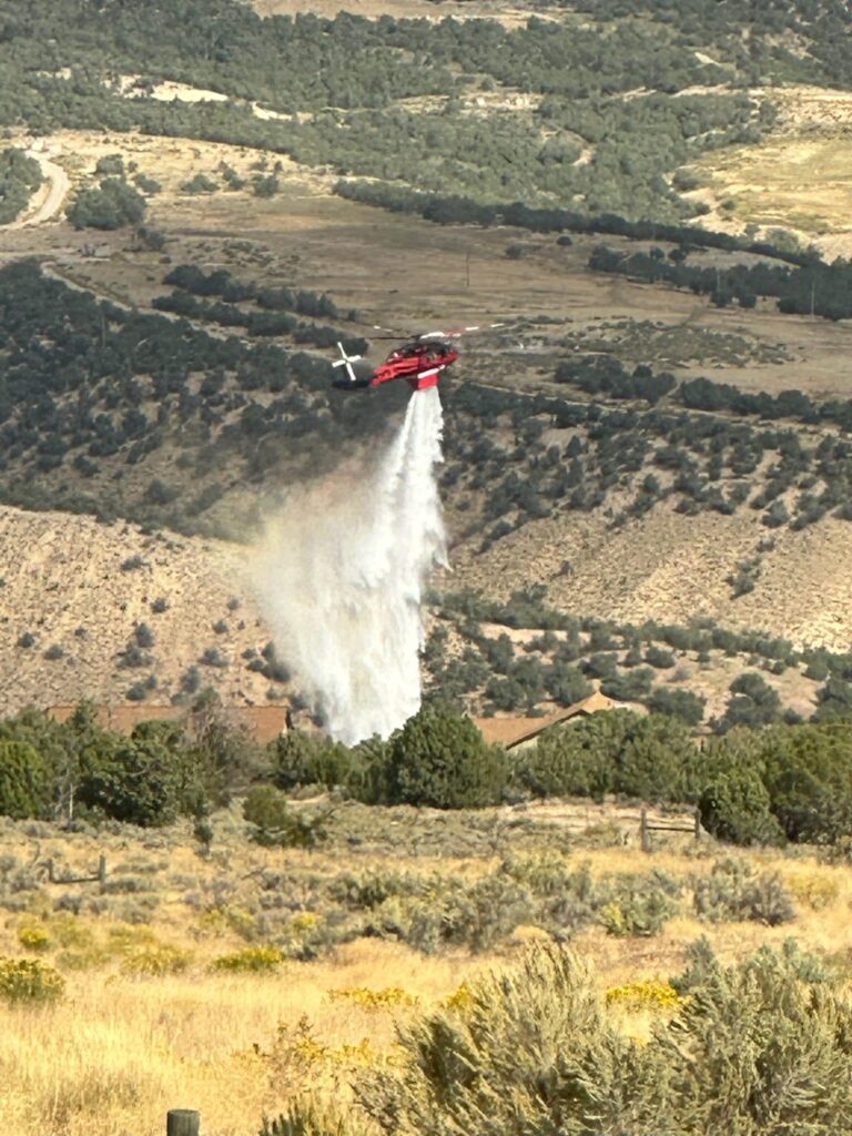
10.1.23, 6:40 p.m. – On Saturday evening, Sept. 30, 2023, several fires started in Garfield County due to lightning strikes. Most of the fires were limited in scope to a single tree and/or the area immediately surrounding the tree. One fire began near the 3-mile mark on CR 301 near Rulison. Some residents lost power and others were directed to evacuate due to the proximity of their residences to the fire.
Grand Valley Fire Protection District Fire responded immediately and worked to protect existing structures and properties as well as assure the safety of the residents. Unfortunately, one home was lost as the firefighters were forced to withdraw due to the intensity of the blaze.
By early Sunday morning, at 12:30 a.m., deputies were clearing the area. Two unmanned road closures, one at the intersections of County Road 301 and CR 309 and a second closure at the intersection of CR 301 and CR 355. The Garfield County Fairgrounds were made available to residents to receive any livestock or other animals from the area that needed to be housed until the fire could be contained.
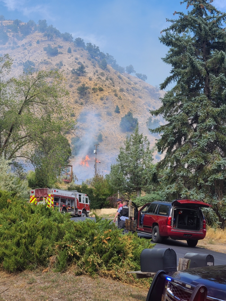
A briefing was held on Sunday at 7 a.m. Mutual aid came from several sources including Colorado River Fire Rescue, De Beque Fire, the Vail Fire Department, Interagency Fire, the Greater Eagle Fire District, Carbondale Fire, and Aspen Fire.
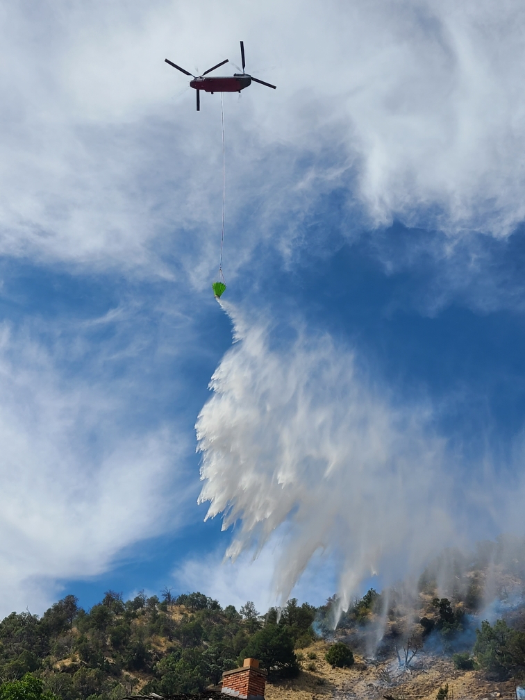
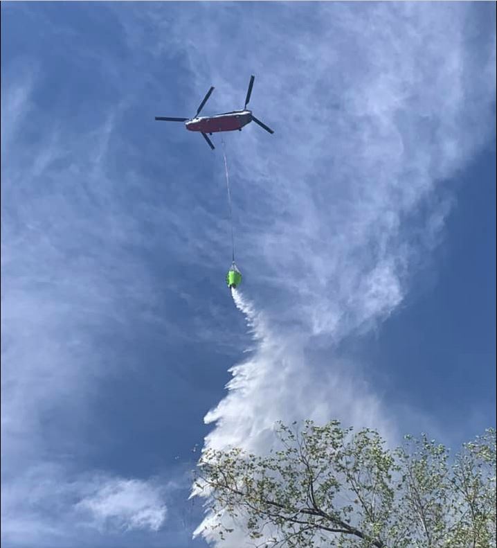
Air resources were ordered by Incident Commander Chris Bornholdt. Various airdrops were made beginning at 10 a.m. on Sunday with the idea to minimize the spread of the fire by establishing a perimeter.
By 4 p.m. Sunday, it was reported that the area residents have been down-graded to a “pre-evacuation” status meaning residents could be at home but should be prepared to evacuate on short notice should conditions change. The fire is currently at approximately 100 acres and holding. There is 0% containment at this time with 102 firefighters on scene between ground and aircrews.
Grand Valley Fire Protection District
10.1.23, 10:03 am – The fire is currently approximately 200 acres. We have a multitude of ground resources en route. Operations are unified command with Garfield County Sheriff’s Office. Two helicopters are currently flying overhead. Please limit traffic on County Road 301 and County Road 309. Evacuation orders are also still in place between County Road 301 and 309. We will post updates as often as possible with new information. Grand Valley Fire Protection District facebook
Garfield County Sheriff’s Office
9.30.23, 9:53 pm – Lightning strike resulting in fire on Morrisania Mesa (County Road 301 at mile marker 3). Please stay away from this area and let the first responders do their job. Garfield County Fairgrounds is open to animals displaced by the fire. Garfield County Sheriff’s Office facebook