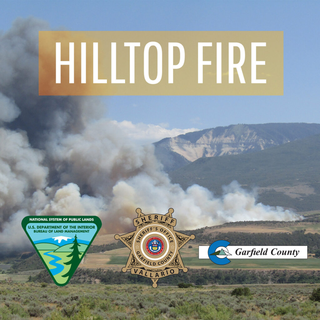
EVACUATE IMMEDIATELY: CR 309 (Rulison-Parachute Road) to main Rulison exit, mile marker 81, due to fire

Garfield County Sheriff’s Office

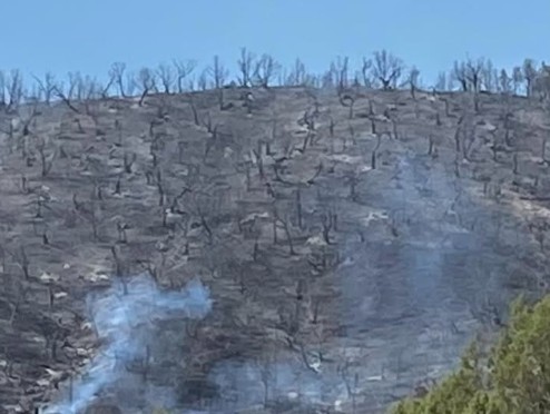
A scorched hillside in the Cottonwood Fire near Rulison, CO.

July 18, 2025, 9:56 a.m. – All evacuations remain in place at this time. Please do not call Garfield County Emergency Communications Authority (dispatch) for updates — their lines are overwhelmed, and it’s critical we keep them clear for emergencies.

We’ll share updates as soon as we have them. Fires can be unpredictable, and information isn’t always immediately available. We appreciate your patience as we work to keep everyone safe. Parachute Police Department Grand Valley Fire Protection District

Garfield County Emergency Communications Authority

July 17, 2025, 10:20 p.m. – Road open – Hwy 6 is open between mile-markers 77 and 83 both directions, Parachute to Rulison.

July 17, 2025, 4:38 p.m. – EVACUATION: County road 309 (Rulison-Parachute Road) to main Rulison exit, mile marker 81: Due to the fire, evacuate the area immediately.

17 de julio de 2025, 4:38 p.m. – EVACUACIĂ“N: Carretera del condado 309 (Rulison-Parachute Road) hasta la salida principal de Rulison, marcador de milla 81: Debido al incendio, evacue el área de inmediato.

EVACUATE IMMEDIATELY: CR 309 (Rulison-Parachute Road) to main Rulison exit, mile marker 81, due to fire

Evacuate immediately: All residences within one mile of 1800 County Road 309 (Rulison-Parachute Road) due to fire; Highway 6 closed

Garfield County Emergency Communications Authority

July 17, 2025, 4:38 p.m. – EVACUATION: County road 309 (Rulison-Parachute Road) to main Rulison exit, mile marker 81: Due to the fire, evacuate the area immediately.

17 de julio de 2025, 4:38 p.m. – EVACUACIĂ“N: Carretera del condado 309 (Rulison-Parachute Road) hasta la salida principal de Rulison, marcador de milla 81: Debido al incendio, evacue el área de inmediato.

Garfield County Sheriff’s Office

A fire burns off County Road 309 (Rulison-Parachute Road).

July 17, 2025, 4:38 p.m. – Brush fire is burning on County Road 309, just south of I-70 near mile marker 79 (between Parachute and Rulison).
Evacuations: Residents within a one-mile radius of 1800 County Road 309 are under evacuation orders.
Road closures: Highway 6 is closed in both directions between mile markers 77 and 83 (Parachute to Rulison).

17 de julio de 2025, 16:38 – Un incendio forestal arde en la carretera del condado 309, justo al sur de la I-70, cerca del kilĂłmetro 79 (entre Parachute y Rulison).
Evacuaciones: Se ordena la evacuaciĂłn a los residentes en un radio de una milla alrededor del kilĂłmetro 1800 de la carretera del condado 309.
Cierres de carreteras: La autopista 6 está cerrada en ambas direcciones entre los kilómetros 77 y 83 (de Parachute a Rulison).

Garfield County Emergency Communications Authority

July 17, 2025, 4:25 p.m. – Highway 6 is closed between mile markets 77 and 83, both directions, Parachute to Rulison, due to a fire.

17 de julio de 2025, 16:25 – La autopista 6 está cerrada entre los mercados de millas 77 y 83, en ambas direcciones, de Parachute a Rulison, debido a un incendio.

July 17, 2025, 3:11 p.m. – Residences in one mile of 1800 County Road 309 (Rulison-Parachute Rd): Due to a fire, evacuate the area immediately.

17 de julio de 2025, 3:11 p. m. – Residencias en una milla de 1800 County Road 309 (Rulison-Parachute Rd): Debido a un incendio, evacue el área de inmediato.

Grand Valley Fire Protection District

July 17, 2025, 3:04 p.m. – New vegetation fire: Cottonwood Fire. Evacuations have been requested for a 1 mile radius around the fire, per unit on scene. Pre-Evacuations have been requested for a 2-mile radius around the fire.

17 de julio de 2025, 15:04 – Nuevo incendio de vegetaciĂłn: Incendio Cottonwood. Se solicitan evacuaciones en un radio de 1 milla alrededor del incendio, por unidad en el lugar. Se solicitan preevacuaciones en un radio de 2 millas alrededor del incendio.

Parachute Police Department

July 17, 2025, 4:24 p.m. – ATTENTION: Cottonwood Park Rodeo Grounds, 100 La Plata Cir, Parachute, is open for your evacuated livestock.

17 de julio de 2025, 4:24 p.m. – ATENCIĂ“N: Cottonwood Park Rodeo Grounds, 100 La Plata Cir, Parachute, está abierto para su ganado evacuado.

July 17, 2025, 4:54 p.m. – Please go to https://garco911.com/emergency-notification-system/ and subscribe in order to receive the most up to date information. Thank you.

Parachute and Battlement Mesa are NOT under evacuation/pre-evacuation order at this time. Current fire activity is going east.

17 de julio de 2025, 16:54 – Visite https://garco911.com/emergency-notification-system/ y suscrĂ­base para recibir la informaciĂłn más actualizada. Gracias.

Parachute y Battlement Mesa NO están bajo orden de evacuación/preevacuación en este momento. El incendio se dirige hacia el este.

Evacuate immediately: All residences within one mile of 1800 County Road 309 (Rulison-Parachute Road) due to fire; Highway 6 closed

Some Western Slope public lands enter stage 2 fire restrictions

Upper Colorado River Interagency Fire Management Unit

July 16, 2025, 4 p.m. – The Bureau of Land Management will implement stage 2 fire restrictions for all lands managed by the Grand Junction Field Office, and lands managed by the Colorado River Valley Field Office within Garfield County effective 12:01 a.m. July 17. White River National Forest remains in stage 1.

Recent hot and windy conditions across Colorado have dried out the lower elevation landscape, and much of the Western Slope is under severe to extreme drought.

“The conditions across our region are significantly drier and more volatile than normal for mid-July,” said Upper Colorado River Interagency Fire Management Officer Tommy Hayes. “Prolonged heat, low humidity, and steady winds have rapidly dried out vegetation — especially native grasses, sagebrush and pinyon-juniper shrubs.”

Because of current conditions, a current National Wildland Fire Preparedness Level of 4, and several active fires in the region, officials decided to increase fire restrictions where most appropriate.

In addition to stage 1 restrictions, the following are prohibited on BLM-managed lands:

  • Building, maintaining, attending or using a fire, campfire, charcoal grill, coal, wood stove fires, including in developed camping and picnic grounds. Devices using pressurized liquid or gas are exempted.
  • Smoking, except within an enclosed vehicle, trailer, building or tent.
  • Using an explosive requiring fuse or blasting caps, fireworks, rockets, exploding targets and tracers or incendiary ammunition.
  • Operating a generator, chainsaw or any equipment powered by an internal combustion engine without a spark arresting device properly installed, maintained and in effective working order meeting either:
  • Welding, or operating an acetylene or other torch with open flame.

Additionally, people should avoid parking in tall, dry grass; use working spark arresters on off-highway vehicles; and inspect trailers regularly to ensure chains do not drag.

BLM initiates restrictions to reduce the risk of wildfires and protect the public. Fire restrictions are implemented based on specific criteria, including the moisture content of vegetation, weather outlooks, and human risk factors.

For more information, please contact the Grand Junction Field Office at 970-244-3000 or the Colorado River Valley Field Office at 970-876-9000.

Fire restriction orders are available at BLM Colorado Upper Colorado River District Fire Restrictions.

The Colorado National Monument will enter stage 2 fire restrictions effective 12:01 a.m. Thursday.

The Grand Mesa, Uncompahgre, and Gunnison national forests will stay in stage 1 fire restrictions.

Some Western Slope public lands enter stage 2 fire restrictions

Stage 2 fire restrictions begin Thursday, July 17

Garfield County Sheriff’s Office

July 16, 2025, 12 p.m. – The Garfield County Sheriff’s Office, BLM lands in Garfield County, and the seven fire districts in Garfield County are implementing Stage 2 Fire Restrictions effective at 12:01 a.m. Thursday July 17, 2025. This applies to all of Garfield County.

This decision was made with thoughtful consideration. We look at the data as well as the potential for significant wildfires and balance it with the impacts to our community. The current active wildfires in Colorado have already stretched our available resources and effected our ability to respond as necessary.

Fire restrictions are implemented based on specific criteria to including moisture content of vegetation, weather outlooks, human risk factors and firefighting resource availability.

What Stage 2 fire restrictions mean in Garfield County

A) Use of fireworks – Not permitted

B) Burn permits (general) – No burn permits will be issued. All previously issued burn permits are cancelled.

C) Recreational fires – No recreational fires

D) Cooking fires – Use caution and keep attended. Cooking devices must be clean (including gas cylinder) and in proper working order.

a. Gas grills – No permit required.

b. Charcoal and other solid fuel grills and cookers – No permit required in developed areas only.

c. In undeveloped areas, a permit from the local fire department may be required.

E) Smoking – Open smoking allowed in developed areas.

a. In undeveloped areas, allowed only in an enclosed vehicle or building.

F) Welding and spark-emitting cutting (hot work) – Developed area: Use extreme caution and take preventative measures as necessary.

a. Undeveloped area: Industrial use only. A permit from the local fire department may be required. Must be in a cleared area at least 10 feet in diameter with a designated lookout. Must have Class A fire extinguishing capabilities readily available.

G) Operating of internal combustion engine-powered equipment, such as chainsaws, hand-held tools, or generators without a spark-arresting device is prohibited. If described equipment does have a spark arresting device, you must have Class A fire extinguishing capabilities readily available, and round-point shovel (36? length minimum) shall be readily available for use.

H) Other internal combustion engine-powered equipment, such as tractors and mowers: Operate with extreme caution paying special attention in areas subject to extreme conditions that may be susceptible to ignition (dry weeds and grasses, etc.).

I) Use of explosives, explosive targets and steel or tracer bullets – Not permitted

J) Use of firearms – Steel jacket/core bullets (Armor Piercing) and tracer bullets are expressly prohibited. It is the responsibility of each independent range to ensure safe fire conditions at all times the range is in use. This includes: mitigating fuels that may potentially catch fire; monitoring downrange conditions/impacts; maintaining the ability to access and rapidly extinguish fires; notifying the local fire department immediately in the event of a fire of any size. Keeping a usable fire-extinguishing application method on hand is strongly recommended.

a. If shooting at an unattended range – including those on public and private property – the responsibility for ensuring safe fire conditions falls on the independent shooter.

By definition:

A “developed area” is an area, whether within city limits or rural, that is groomed, manicured and or watered, where grasses, brush and trees are regularly attended to by landowner. This includes residential and business areas, improved recreational areas, parks and other common areas.

“Undeveloped areas” are lands that are not groomed, manicured, or watered; where grasses, brush and trees have been allowed to grow in a natural environment. This includes green belts that are not landscaped or manicured, open space lands, non-manicured parklands, and other areas where the fire hazard presented by the vegetation is determined by the authority having jurisdiction or designee to be an undue wildland fire hazard.
Stage 2 fire restrictions begin Thursday, July 17

Air quality health advisory for wildfire smoke

Colorado Air Pollution Control Division – Colorado Department of Public Health & Environment

July 16, 2025, 8 a.m. – An air quality health advisory for wildfire smoke issued for Mesa, Garfield, Eagle, Pitkin, Lake, Delta, Gunnison, Chaffee, Montrose, San Miguel and Ouray counties.

Affected area: Mesa, Garfield, Eagle, Pitkin, Lake, Delta, Gunnison, Chaffee, Montrose, San Miguel and Ouray Counties. Locations include, but are not limited to Grand Junction, Glenwood Springs, Eagle, Vail, Aspen, Leadville, Delta, Gunnison, Buena Vista, Salida, Montrose, Nucla, Telluride, and Ouray.

Advisory in effect: 8 a.m. MDT, Wednesday, July 16, 2025 to 9 a.m. MDT, Thursday, July 17, 2025

Public health recommendations: If smoke is thick or becomes thick in your neighborhood you may want to remain indoors. This is especially true for those with heart disease, respiratory illnesses, the very young, and older adults. Consider limiting outdoor activity when moderate to heavy smoke is present. Consider relocating temporarily if smoke is present indoors and is making you ill. If visibility is less than 5 miles in smoke in your neighborhood, smoke has reached levels that are unhealthy.

Outlook: Multiple wildfires will produce periods of moderate to heavy smoke across the advisory area through early Thursday morning. The heaviest smoke impacts will likely be in close proximity to the South Rim fire in eastern Montrose County, the Sowbelly Fire and Turner Gulch fires in southern Mesa County, and areas directly downwind of the Deer Creek fire in Montrose and San Miguel Counties. Thunderstorms are possible near the fires on Wednesday, and may produce gusty, erratic winds that can send smoke in any direction.

Air quality health advisory for wildfire smoke

CRFR: Responding to brush fire

Colorado River Fire Rescue

7.10.25, 2:14 pm: – After a 2.5-hour hike early this morning, CRFR crews finally made it to the scene of a half-acre brush fire in the New Castle area on a ridge between the Colorado River and Alkalai Creek. The call came in at 2:40 a.m. as a report of a lightning strike, but due to unpredictable terrain, crews waited until sunrise to make the trek to the fire, which is in heavy oak brush.

CRFR is on scene with Engine 361 and a crew of four. Upper Colorado River Interagency Fire Management Unit is on scene with an engine and crew of six. The Whiteriver Mod is on scene with a crew of eight, and a helicopter is making water drops. The plan is to work through the day today and have this fire wrapped up tomorrow.

Visit CRFR on Facebook.

CRFR: Responding to brush fire

Hilltop Fire update

Upper Colorado River Type-3 Interagency Incident Management Team

Hilltop fire photo with Bureau of Land Management, Garfield County Sheriff's Office and Garfield County logos

RULISON, CO – The Hilltop Fire has officially been declared contained as of 8 pm tonight. Tomorrow at 7 am, the incident will transition back to a Type 4 Incident Command structure. Remaining resources will continue to patrol, mop-up, and ensure that existing containment lines are secure. The Incident Commander estimates full control tomorrow, June 29th, at 8 pm.

According to Chris Bornholdt, Garfield County Emergency Operations Commander, “Evacuations were lifted last night, and residents were allowed to go back home. We appreciate everyone’s patience throughout this unfortunate event. We would like to thank the firefighters and support personnel from the countless agencies who’ve worked tirelessly to suppress this incident.”

Please note that due to very high fire danger, Stage 1 fire restrictions are currently in effect in unincorporated Garfield County and on lands managed by the Bureau of Land Management and White River National Forest.

Hilltop Fire update

Interagency firefighters work diligently to stop spread of Hilltop Fire

Upper Colorado River Type-3 Interagency Incident Management Team

Bureau of Land Management, Garfield County Sheriff's Office and Garfield County logos

NEWS RELEASE
For Immediate Release
Media Contact:
Renelle Lott, Garfield County Communications Dept., 970.366.2275
June 27, 2025

RULISON, CO – Firefighters from multiple agencies continue fire suppression efforts to contain the Hilltop Fire located about 2 miles southeast of Rulison. More accurate mapping indicates the fire is currently at 326 acres and is 40% contained. Approximately 20-25 structures are at risk in the evacuation area.

A total of 153 personnel are currently on-scene. Resources include 13 engines, two type-2 initial attack crews, type-2 wildland fire module, type-2 suppression module, an interagency hot shot crew, smokejumpers, and support personnel.

Upper Colorado River Type-3 Interagency Incident Management Team assumed command this morning. Agencies providing support include Garfield County Sheriff’s Office, Grand Valley Fire Protection District, Colorado River Fire Rescue, Colorado Department of Fire Prevention and Control, Vail Fire Department, Colorado Springs Fire Department, Loveland Fire Department, and Adams County Fire Protection District.

Crews will continue working throughout the weekend to further containment efforts, suppress hot spots and perform mop-up operations. Safety is a priority for firefighters as they work around burned areas and debris, hot spots, and steep slopes.

Evacuations remain in effect for residents located within one mile of County Roads 320 and 309; pre-evacuation continues for residents more than one mile and within two miles of CR 320 and CR 309. Garfield County Sheriff’s Office is helping evacuees access their homes when safely possible.

Power companies are working to restore damaged poles and wires.

The fire investigator determined that this fire was human-caused and preventable. As a reminder, stage 1 fire restrictions are in effect in Garfield County and on lands managed by the Bureau of Land Management and the White River National Forest. The weather is expected to remain hot and dry, with high temps and no moisture throughout the weekend.

We appreciate the support from the community and our partners. In the interest of public and emergency responder safety, please avoid the area.

We will share more information as it becomes available.

For fire updates and multimedia, visit garfieldcounty.net.

UPDATE: Saturday morning, June 28, 2025, it was announced that evacuations are lifted and displaced residents have returned to their homes. Garfield County is assisting with re-entry and recovery.

Interagency firefighters work diligently to stop spread of Hilltop Fire

GSFD: Palmer Fire – Firefighters work diligently to stop fire spread in difficult terrain

Press release – Palmer Fire

At around 6:56 p.m., the Glenwood Springs Fire Department received a report of a brush fire on the hillside east of the 2500 block of Palmer Avenue.

Upon arrival, fire crews found a quarter acre active fire located near the base of a steep sloped canyon with challenging terrain. Fire was spreading quickly uphill into thicker vegetation. At once, firefighters promptly initiated fire attack, ordered additional resources, and identified structures at risk. Thanks to the Garfield County Sheriff Officers and the Glenwood Springs Police Department three of the closest Altitude Apartment buildings were safely evacuated. Evacuees were able to return to their homes later in the night.

Carbondale & Rural Fire Protection District, Roaring Fork Fire Rescue, and the Upper Colorado River Interagency Fire Management Unit responded with resources including a type 1 Black Hawk helicopter. The helicopter dropped water on the fire effectively slowing the growth of the fire enabling firefighters to complete constructing line around the fire using anchor, flank, and pinch strategy. By 10:00 pm last night, firefighters successfully constructed direct hand line around the entire fire perimeter. Firefighters monitored the fire throughout the night and resumed mop up operations at 7:30 am this morning. By 8:30 am this morning, Incident Commander Hood called the fire 100% contained with an approximate size of one and a half acres. Firefighters will continue to monitor the burn area to watch for any signs of the fire rekindling.

In response to the incident, there were a total of three type-one engines, two type-six engines, five command vehicles, one investigation vehicle, a type 1 Black Hawk helicopter, along with 23 personnel from Carbondale and Rural Fire Protection, Roaring Fork Fire Authority, and the Upper Colorado River Fire Management Unit. Additionally, the Garfield County Sheriff’s Office, Glenwood Springs Police Department responded to this incident. The Glenwood Springs Fire Department is immensely grateful for the response from these partner agencies.

Incident Commander Hood stated, “The quick deployment of air resources and immediate response and hard work from our mutual aid partners kept the fire from getting out of control.”
The Glenwood Springs Fire Marshal has declared the cause of the fire undetermined human caused in nature. Fortunately, no injuries have been reported at this time. No further information will be provided.

GSFD: Palmer Fire – Firefighters work diligently to stop fire spread in difficult terrain

Garco911 and Department of Public Health & Environment: Air quality alert

Department of Public Health and Environment

6.27.25
Affected Area: Garfield County. Locations include, but are not limited to Rulison and Parachute.
Advisory in Effect: 8:00 AM MDT, Friday, June 27, 2025 to 9:00 AM MDT, Saturday, June 28, 2025
Public Health Recommendations: If smoke is thick or becomes thick in your neighborhood you may want to remain indoors. This is especially true for those with heart disease, respiratory illnesses, the very young, and older adults. Consider limiting outdoor activity when moderate to heavy smoke is present. Consider relocating temporarily if smoke is present indoors and is making you ill. If visibility is less than 5 miles in smoke in your neighborhood, smoke has reached levels that are unhealthy.
Outlook: The Hilltop wildfire is producing heavy smoke Friday morning for areas along Interstate 70 from Rulison westward into Parachute. Smoke should decrease across the advisory area late Friday morning as atmospheric mixing increases. However, active fire behavior is possible Friday afternoon. This may result in heavy smoke impacts again for the advisory area late Friday night and into Saturday morning.

Garfield County Emergency Communications Authority

6.27.25, 9:35 a.m. Smoke in the air: Air quality health advisory for wildfire smoke in Garfield County, including Rulison and Parachute, is in effect today from 8:00 AM to 06/28/25 at 9:00 AM.

Garco911 and Department of Public Health & Environment: Air quality alert